Google Earth’s newest Timelapse feature lets users look back from current day all the way to 1984 and see how both human activity and natural forces have changed the face of Earth over last 40 years. The feature makes use of some 24 million satellite photos gathered by Google Earth from NASA, the US Geological Survey (USGS), the European Union, and the European Space Agency (ESA).
The new imagery is free to access and use, like the rest of Google Earth, and will be updated annually.
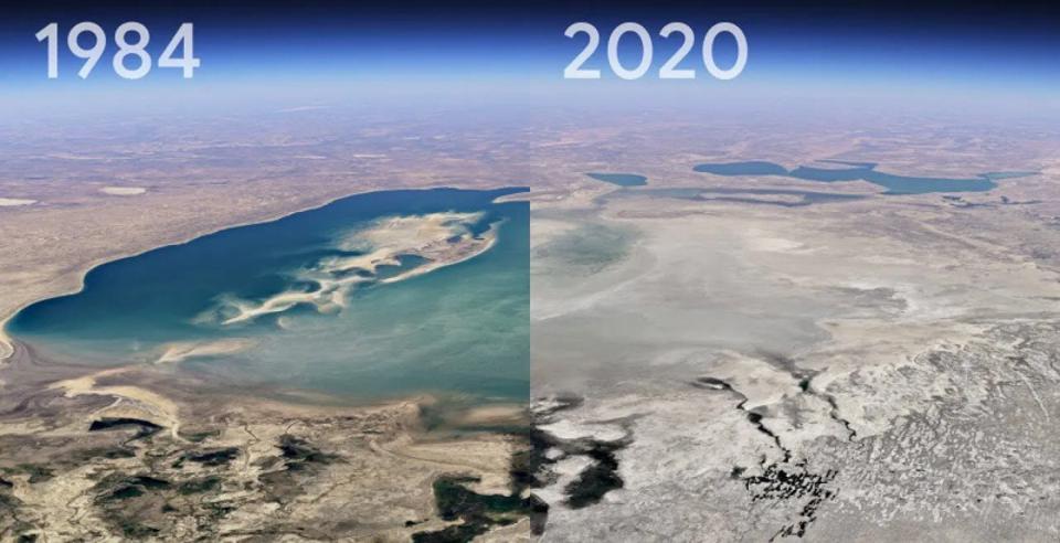
Google itself has highlighted a few areas of geological interest like the Mount Pinatubo in the Philippines, the Columbia Glacier and the changing Aral Sea, Kazakhstan.
Source: Forbes

Inflics provides it readers the information that they need in concise and short articles, making information and news more accessible to everyone.